
Town Planning
A series

Many years ago I was invited to attend my daughter’s third grade class and talk to the students about what an architect does.
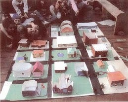
I thought, instead of just talking about it, we would do a quick project on town planning. That class continued through the semester and every Friday I visited the class and marveled at their progress. By the end of the year, they had an entire town planned and built to scale.
That was the beginning of my teaching “career” and to this day I still enjoy it, seeing the light go on when a student gets it or accomplishes what they want to do whether it’s to understand a concept, learn how to draw a certain way or complete a model. They get it and I love it.
There is a lot to consider in terms of planning a town so we will take one aspect at a time.
The first thing architects do is create a program. A program is determining what is needed whether it is an office space, a building, a restaurant or a town.
An architect sits down with the client and goes over all of the details, what is needed and what is on the client’s wish list. Then we go back to the office, work out the amount of area needed for the project, review it with the client and it becomes our checklist. This list is something we go back to many times along with all of the design team members to ensure we have covered the requirements.
The next step is the overall design. We begin with what are called “bubble diagrams” and those diagrams eventually become streets and buildings along with all of the necessary infrasturcture.
This quick video gives you an idea of how we get started:
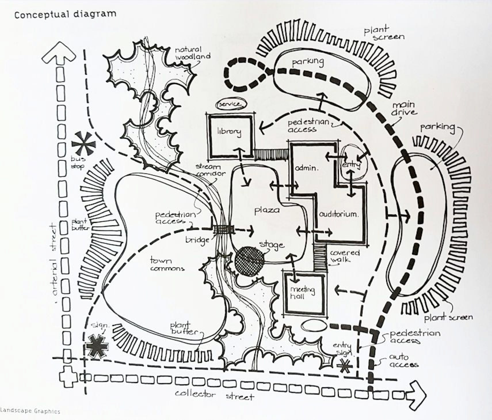
Here is an example of an idea for a town center:
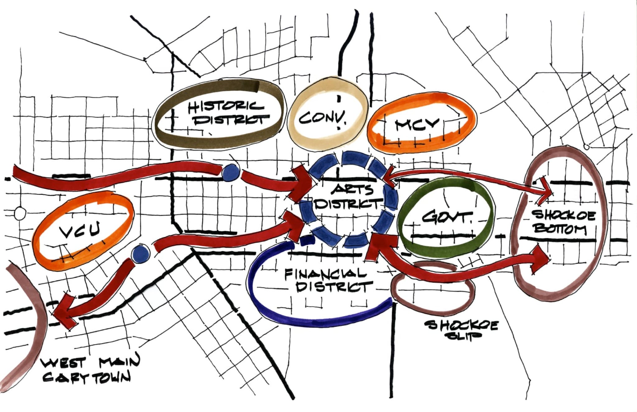
And an example of having the arts district as the focal point of a community:
It usually takes a lot of trace paper and pencil lead before we come up with the final design but that is part of the creative process.
Before you get started on your idea of a town, let’s look at how towns and cities were planned or, in some cases, not planned.
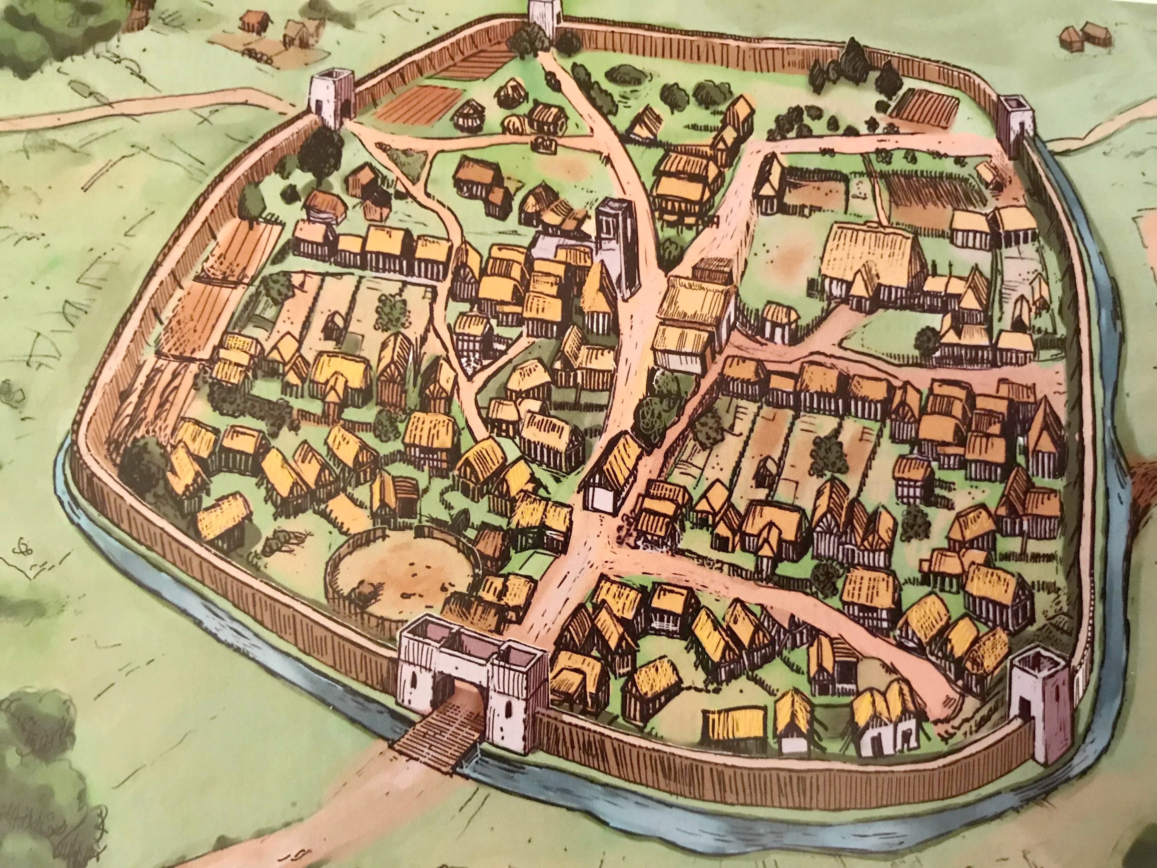
When we began to rely on agriculture to live rather than be, hunter/gatherers, communities were formed and eventually, for protection, a wall encirlced a town.
Below is what was called a “burh”, an idea Alfred the Great had around 871 AD to protect towns from the invading Vikings.
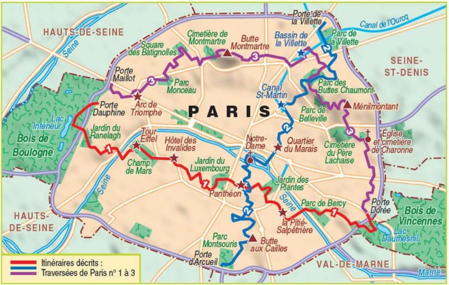
In a city such as Paris, the wall that protected the inhabitants from invaders has since been replaced by a highway loop that shows clearly where the wall orignally existed.
Below is the town of Palmanova in Italy and referred to as the “star fort” for the walls built for the protection of the inhabitants.

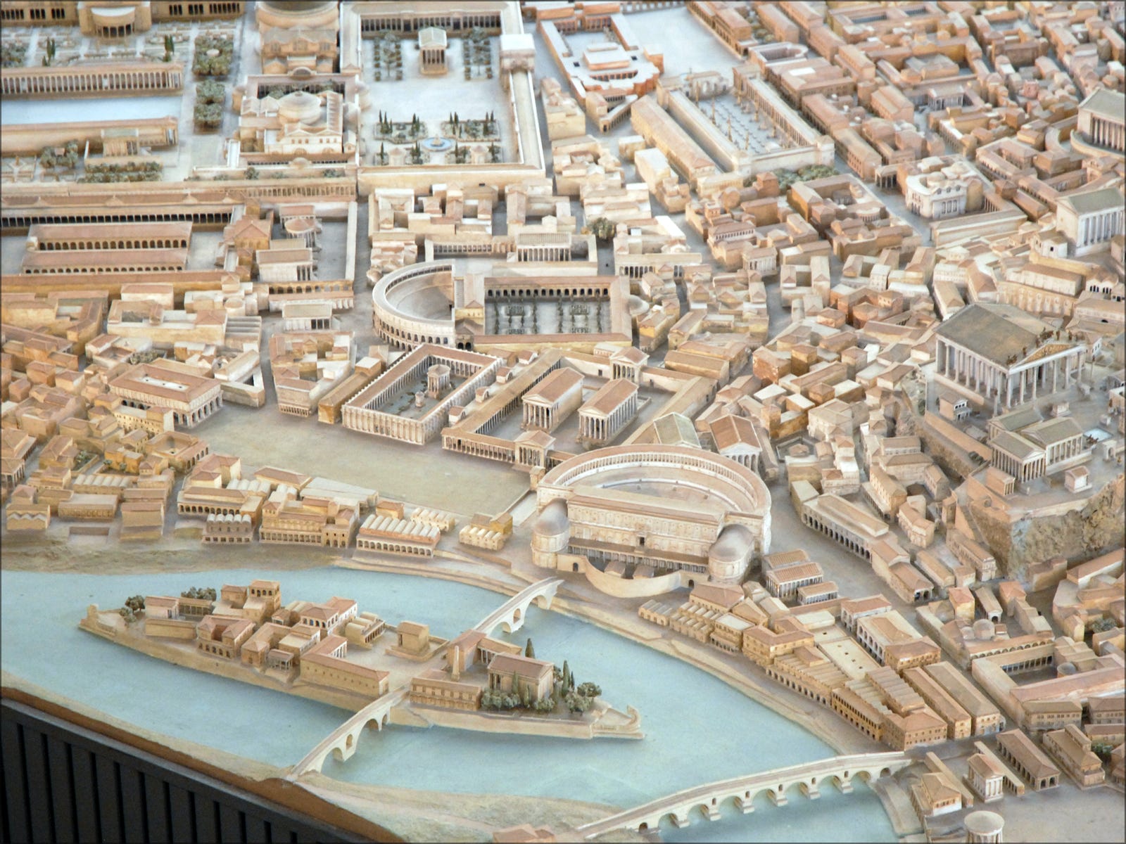
Originally many times towns were haphadzardly built, with one person deciding to build their home in a certain location, then maybe a market was set up or a place of worship along with what eventually became a town center such as in early Rome.
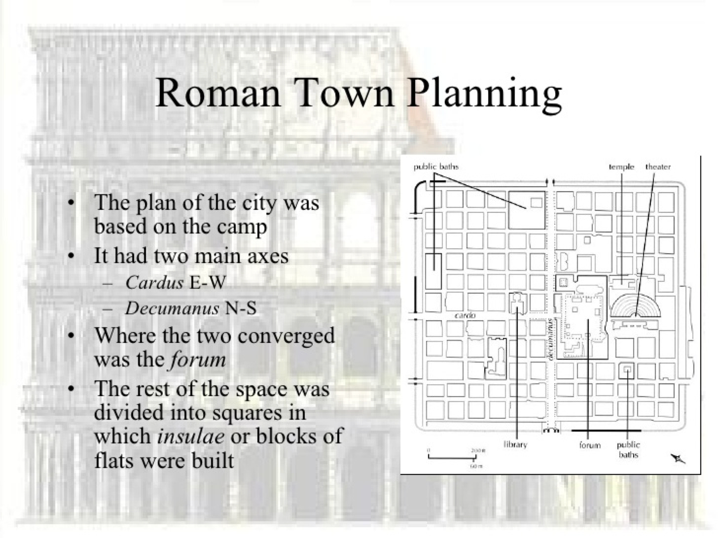
What is interesting about Rome is that when it came to housing soldiers who were located around the Mediterranean, it was very logical and formal. This way it was easy to find a specific soldeir based on the "row” he was on and the tent number.
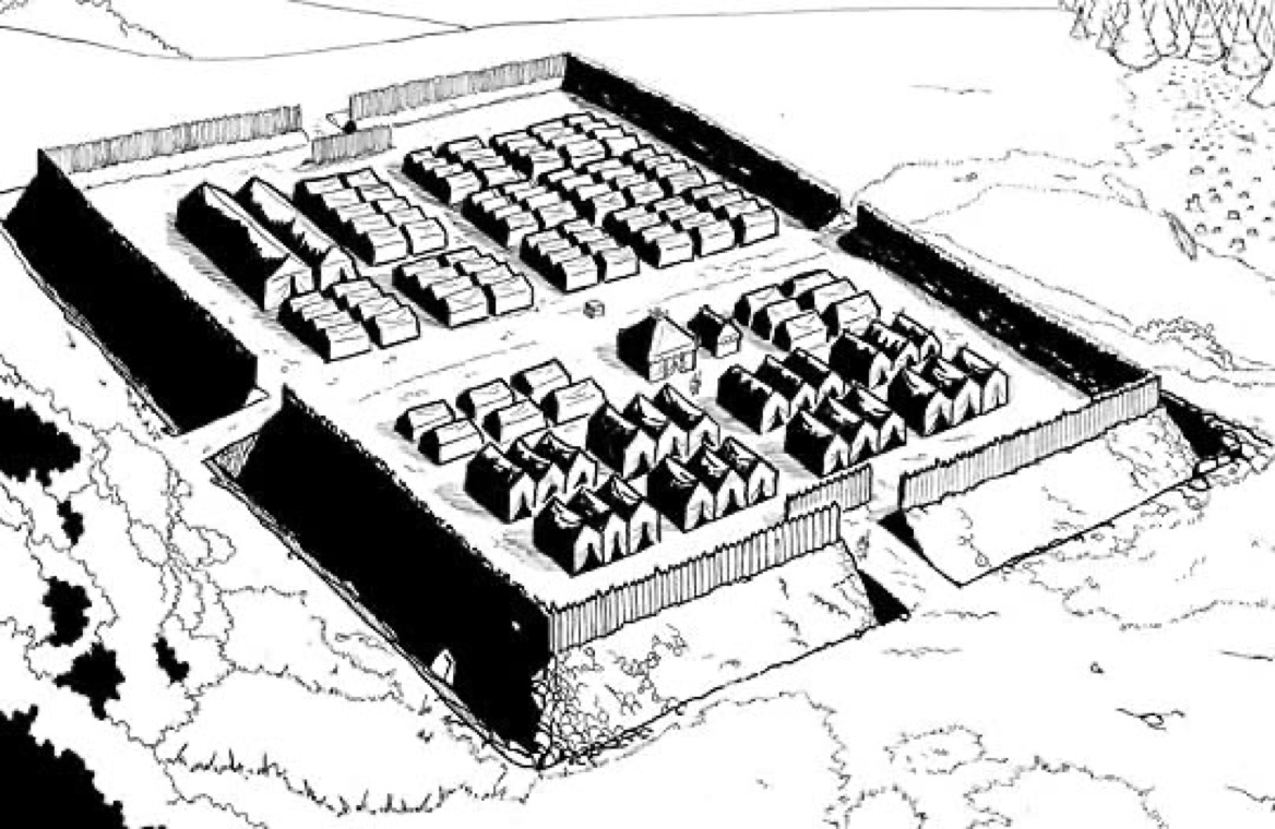
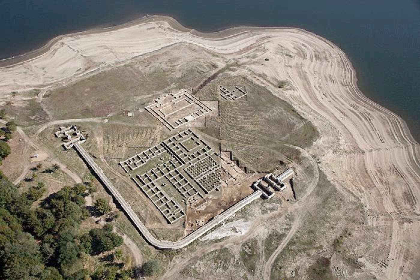
This became the way Roman towns began to be organized.
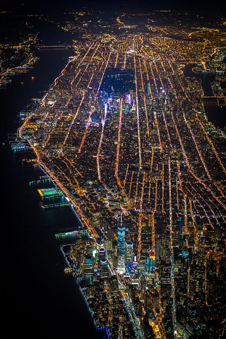
Since then many towns and cities use the grid to organize locations and spaces. For example, Manhatten.
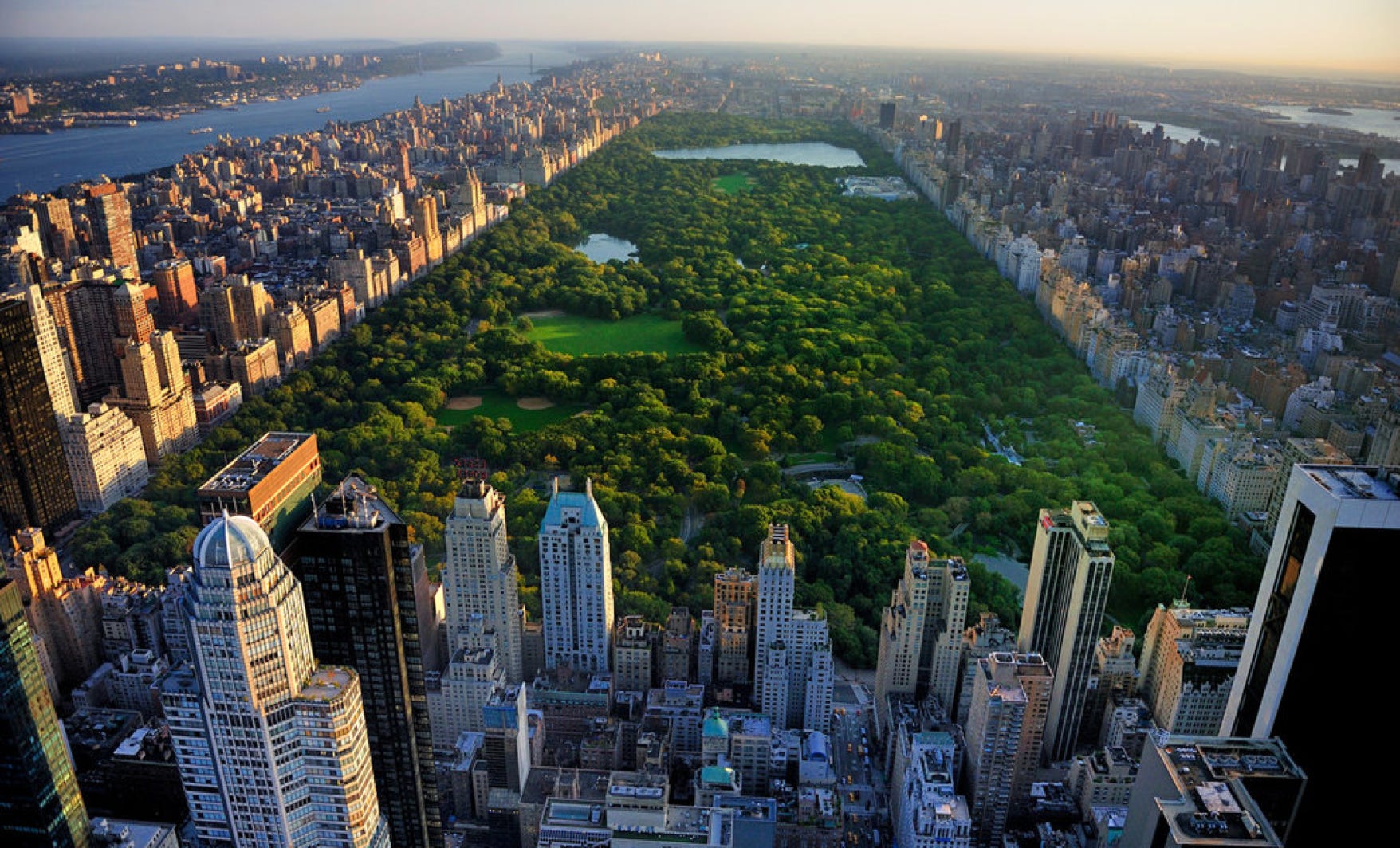
Fortunately, what breaks up the grid in New York City is Central Park which originally was considered to be part of the countryside to be visited on a weekend trip from Lower Manhatten.
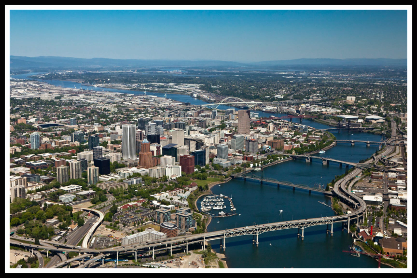
Other towns began around a river or another body of water such as Portland, Oregon. The river divides the downtown area and the suburbs in Portland.
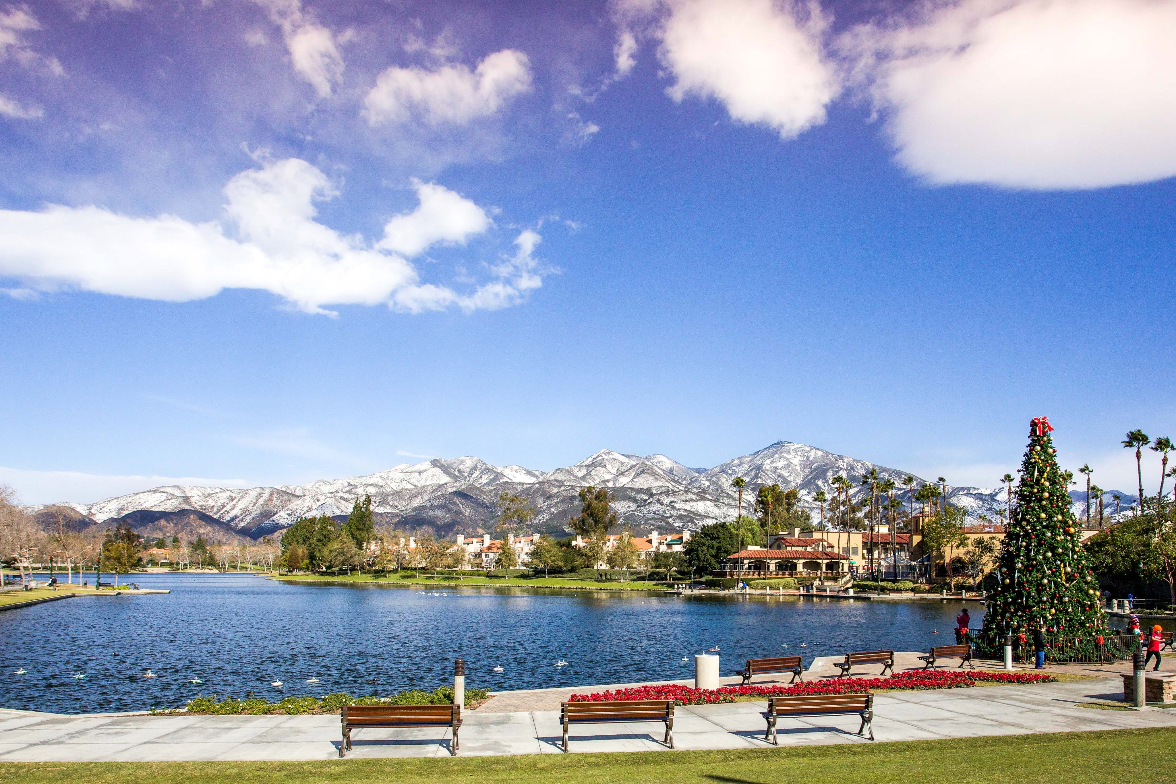
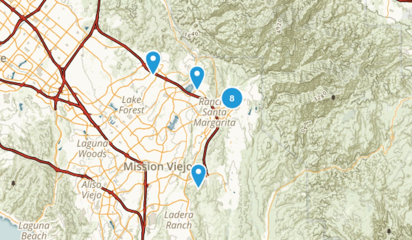
In Orange County, California, the planners decided to follow the idea of the winding roads that grace the hillsides of the English countryside, adding man-made lakes.
Next we will look at ideas city planners and architects are considering for communities that do not rely on cars for transportation.
-Dora Taylor